Both Nokia N95 and N82 have built-in GPS receivers but until now Nokia has not integrated that function with the camera. Yesterday, Nokia released an application called Location Tagger through its Beta Labs that does precisely that.
Once installed, the application icon turns up in the application folder. The application is very simple and by just running it and putting it in the background. The status of the GPS reception is shown by a small icon at the top of the display. The application will maintain its location through the GPS receiver and automatically store the position as EXIF data in the image files. Other applications can then use that information for different purposes, e.g. to show where the images were taken on a map.
The GPS receiver in the phone is known to be quite good at draining the battery in no time. Luckily, the Nokia developers have thought of this and the application automatically turns off the GPS receiver after a couple of minutes after the last picture is taken. By default, this period is set to five minutes.
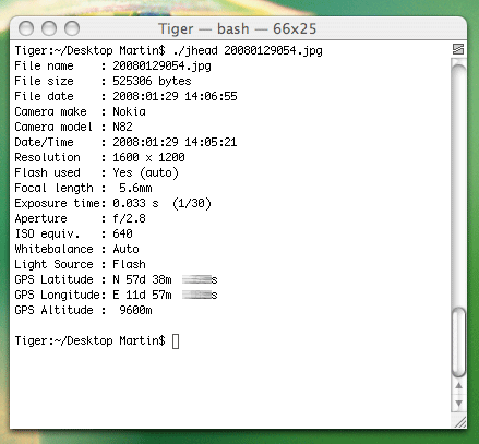
Below is a dump of EXIF tags on a picture taken by my Nokia N82 with Location Tagger.

Location Tagger can be downloaded from here.
Now, I just have to adapt my WordPress photoblog to be able to show the position and link to Google Maps.
One reply on “Nokia releases geo-tagging software”
Hi!
looked anymore into the geotagging photos? I have been experimenting a bit with it, mainly with photos from hikes in the mountains. I have started with some ajax stuff towards flickr to get a google map with icons for each image. Maybe we should try to get something done together?
/Kalle